Kayak Fishing Adventures on Big Water’s Edge  

Go Back   Kayak Fishing Adventures on Big Water’s Edge > Kayak Fishing Forum - Message Board > General Kayak Fishing Discussion
Home Forum Online Store Information LJ Webcam Gallery Register FAQ Community Calendar Today's Posts Search

Reply
 
Thread Tools Display Modes
Old 07-19-2010, 05:02 PM   #1
roadx
.
 
roadx's Avatar
 
Join Date: May 2010
Posts: 1,155
Kayak launching sites

has anyone been to theses launch sites?? are they really accessible to the public? are they easy to get to??

according to the MLPA they do but i have never heard or seen theses sites
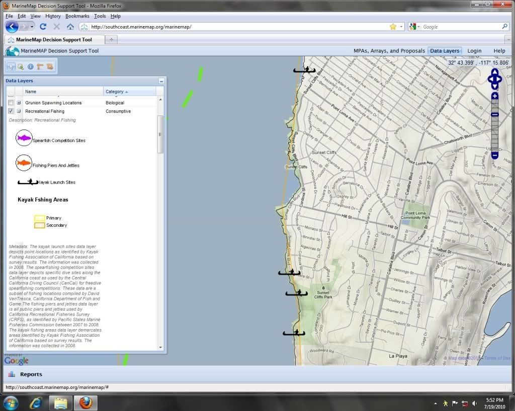

__________________
roadx is offline   Reply With Quote
Old 07-19-2010, 05:31 PM   #2
-scallywag-
Banned
 
Join Date: Mar 2009
Location: on the road...
Posts: 598
hahhaha...look at all those kayak launch sites...i cant believe that everyone is crying about closing LJ when we have all those easily accessable launches right there at the sunset cliffs....


ummm yeh if you have a crane or... if you don't mind carring all your equipment down dirt goat trails on a 60-80ft cliff, then launching from rocky, slippery reefs (usually not much sand) and larger surf...one of those sites has stairs but it is hard enough to get a longboard down them, I'm not sure I could even carry a 15ft, 50lb kayak down those stairs or trails, and i'm young and stupid!!

ohh yeh, then you gotta get back up?? i'm guessing only %10 of the guys that use this forum could actually physically pull a fishing trip out of those "launches"....and I'm not one of them!!!!

Sounds like non-discriminatory public access to me!
-scallywag- is offline   Reply With Quote
Old 07-19-2010, 06:26 PM   #3
dsafety
Olivenhain Bob
 
dsafety's Avatar
 
Join Date: May 2008
Location: Olivenhain, CA
Posts: 1,121
Those are all good snorkeling or scuba diving access sites. Kayak launching... not so much. Who made up that map?

Bob
dsafety is offline   Reply With Quote
Old 07-19-2010, 06:38 PM   #4
roadx
.
 
roadx's Avatar
 
Join Date: May 2010
Posts: 1,155
this is from the marine map decision tool found here

http://southcoast.marinemap.org/marinemap/

Quote:
What is MarineMap?

MarineMap is an online mapping tool developed to assist in the design of marine protected areas (MPAs) in the Marine Life Protection Act Initiative process.
Quote:
Why MarineMap?

MarineMap assists South Coast Regional Stakeholder Group (SCRSG) members in the design of MPAs by allowing them to view oceanographic, biological, geological, chemical and human dimensions of the ocean and coastal areas. MarineMap provides easy sharing of MPA ideas, and reports on how well individual MPAs and arrays of MPAs meet various guidelines set by the Master Plan Science Advisory Team (SAT) to help meet the goals of the MLPA.
__________________
roadx is offline   Reply With Quote
Old 07-19-2010, 07:27 PM   #5
467echo
Rookie of the Month Club
 
467echo's Avatar
 
Join Date: Nov 2008
Location: Mira Mesa
Posts: 483
Just wait until Hobie is done with R&D on the new Helo Drive system!
__________________
they are getting bigger....
467echo is offline   Reply With Quote
Old 07-19-2010, 07:39 PM   #6
old_rookie
Senior Member
 
old_rookie's Avatar
 
Join Date: Mar 2010
Location: Santee
Posts: 904
Here is a view of Sunset Cliffs park which they indicate is a launch area - oh look, I do see a launch ramp!!

http://www.californiacoastline.org/c...gs=0&year=2004
old_rookie is offline   Reply With Quote
Old 07-19-2010, 08:03 PM   #7
Nic D
Senior Member
 
Nic D's Avatar
 
Join Date: Feb 2010
Location: Clairemont
Posts: 813
Quote:
Originally Posted by 467echo View Post
Just wait until Hobie is done with R&D on the new Helo Drive system!
I heard about this one... sounds pretty cool
Nic D is offline   Reply With Quote
Old 07-19-2010, 08:04 PM   #8
dmrides
Senior Member
 
dmrides's Avatar
 
Join Date: Aug 2009
Location: Point Loma
Posts: 584
I have launched several times from Orchard and Bermuda streets. It is a pain in the ass, sketchy and almost not worth the difficulty. It can really only be done a few days a year at mid to high tide with very little swell. Proceed with caution.
dmrides is offline   Reply With Quote
Old 07-20-2010, 05:09 AM   #9
roadx
.
 
roadx's Avatar
 
Join Date: May 2010
Posts: 1,155
the kayak toboggan launch ramp hahaha


Quote:
Originally Posted by old_rookie View Post
Here is a view of Sunset Cliffs park which they indicate is a launch area - oh look, I do see a launch ramp!!

http://www.californiacoastline.org/c...gs=0&year=2004
__________________
roadx is offline   Reply With Quote
Old 07-20-2010, 11:08 AM   #10
rogersmith
Senior Member
 
Join Date: Sep 2008
Posts: 465
it gets more absurd by the day
rogersmith is offline   Reply With Quote
Old 07-20-2010, 12:40 PM   #11
tony
Senior Member
 
Join Date: Apr 2005
Location: La Jolla
Posts: 130
That's a typo on that map. They meant to say Kayak Lunched.....Looks like a good way to eat it.
Oh wait .....here's how you do it.....
http://www.youtube.com/watch?v=TKmAvRYDHW8
tony is offline   Reply With Quote
Old 07-25-2010, 10:06 AM   #12
taggermike
Senior Member
 
taggermike's Avatar
 
Join Date: May 2007
Location: Chula Vista
Posts: 1,589
I think the important part of those alledged launch sights is that they are at Sunset CLIFFS. Emphasis on the word cliffs. I guess any thing is possible but you better have your skills together and a strong back. I've launched all over So Cal, from south IB to the trails in Laguna Beach, and I wouldn't recomend that area. Mike
taggermike is offline   Reply With Quote
Old 07-26-2010, 05:12 PM   #13
PAL
Senior Member
 
Join Date: May 2005
Posts: 754
Pretty funny stuff here.

I can shed some light on these. They are launch sites for some people. I've used two of them - Helo drive, where were you? But there's definitely context missing in the MLPA map these came from, which makes it look like all of these are equally good.

When we were gearing up for our attempt to survive the MLPA, we started with with a mapping project called the KFACA Launch Sites List.

If you go back two or three years, you'll find the invite posts. We asked everyone from pros to kayak fishing newbies to tell us where they fished. This was way before Ecotrust, for kayak anglers by kayak anglers only.

We wanted to document everything, so that we could demonstrate ANY impact. Even if it hit one guy's secret spot, I wanted to know. We also distinguished between Primary sites such as La Jolla, Dana Pt, etc that we'd go to the wall to keep open, and secondary, little-used 'pirate' launches like these.

There's was another strategic side to this. Every user group was expected to sacrifice - to get hurt by losing access. We prefered to give up places like these, not La Jolla or Dana Pt. If I'd have gotten out of the RSG with only secondary sites on the chopping block, it would have been a huge victory.

Of course, that's not what happened. The Malibu guys are set to lose their La Jolla equivalent. At PV, the local kayak guys sacrificed a brand new access point at Terranea in order to keep peace with other fishing allies. Otherwise we it could have been much worse.

I hope that makes sense.
PAL is offline   Reply With Quote
Old 07-26-2010, 05:17 PM   #14
TheBentRod
Senior Member
 
TheBentRod's Avatar
 
Join Date: Jun 2010
Location: Murrieta, CA and Bonney Lake, WA
Posts: 424
Malibu equivalent

Quote:
Originally Posted by PAL View Post
Pretty funny stuff here.

Of course, that's not what happened. The Malibu guys are set to lose their La Jolla equivalent. At PV, the local kayak guys sacrificed a brand new access point at Terranea in order to keep peace with other fishing allies. Otherwise we it could have been much worse.

I hope that makes sense.
What is the Malibu equivalent to La Jolla? I am new to this, please let me know.
TheBentRod is offline   Reply With Quote
Old 07-26-2010, 06:52 PM   #15
dsafety
Olivenhain Bob
 
dsafety's Avatar
 
Join Date: May 2008
Location: Olivenhain, CA
Posts: 1,121
Quote:
Originally Posted by PAL View Post
Pretty funny stuff here.

Otherwise we it could have been much worse.

I hope that makes sense.
Nope! Not to me.

None of this makes any sense to me. How can it be sensible to disregard the science, or the economic impact. Having long ago lost faith in most of our elected officials the only thing I can hold on to is the power of money.

The fact that there are no funding sources for MLPA implementation at the moment may well be our only hope in the short term. This may delay things for a while but not forever.

We need a backup plan.

Bob
dsafety is offline   Reply With Quote
Old 07-27-2010, 03:18 PM   #16
PAL
Senior Member
 
Join Date: May 2005
Posts: 754
Bob, it should be obvious I'm talking about how a grassroots minority - kayak anglers - worked to survive a brutal game of musical chairs with nonsense rules from a dictatorial, privately funded MLPA Initiative.

We worked on the possible. The rest of your wish list requires bigger guns. UASC and SAC's Bob Fletcher are suing the MLPA. That's the backup plan in action.

Quote:
What is the Malibu equivalent to La Jolla? I am new to this, please let me know.
That's the lee of Pt Dume and Pt Dume Canyon, everything from Westward Beach east. It ended up on the chopping block due to pure abuse of power, dirty back room deals, and manipulation between LA interests.

It's the nightmare scenario La Jolla probably escaped. I say probably because nothing is final.
PAL is offline   Reply With Quote
Old 07-27-2010, 06:28 PM   #17
robmandel
Senior Member
 
robmandel's Avatar
 
Join Date: Jun 2009
Posts: 186
Quote:
Originally Posted by PAL View Post
Bob, it should be obvious I'm talking about how a grassroots minority - kayak anglers - worked to survive a brutal game of musical chairs with nonsense rules from a dictatorial, privately funded MLPA Initiative.

We worked on the possible. The rest of your wish list requires bigger guns. UASC and SAC's Bob Fletcher are suing the MLPA. That's the backup plan in action.


That's the lee of Pt Dume and Pt Dume Canyon, everything from Westward Beach east. It ended up on the chopping block due to pure abuse of power, dirty back room deals, and manipulation between LA interests.

It's the nightmare scenario La Jolla probably escaped. I say probably because nothing is final.
don't I know it

worst part of it all is that what got "traded" for malibu was leaving rocky point open. RP gets hammered by the sport boats and the closed area is superfund toxic cleanup site with serious erosion problems. BKR gets little pressure. it's too far to be a regular spot for the LA or the ventura boats.

let's see how the norcal thing is going. sounds like there's some trouble brewing
robmandel is offline   Reply With Quote
Old 07-27-2010, 10:53 PM   #18
tony
Senior Member
 
Join Date: Apr 2005
Location: La Jolla
Posts: 130
Makes sense to me Paul....
Sort of like throwing a bone to a rabies crazed Pitbull when your leg is exposed..... Pretty ingenious if you ask me.

What most people don't understand is that this has nothing to do with conservation on the enemies part. It's all about control and power. If they had been convinced that they had hurt us badly enough with the secondary closures they would be happy....sick but true.....We have to understand that to these people humans are the destructive cockroaches on the planet. We don't deserve to live here..

Hell,that whole children's pool/seal eco-disaster has always been about control and power, masquerading as conservation. The head "friends of the seals" crazy lady openly admitted in an interview with the La Jolla Light that this was about controlling people. Almost fell out of my chair when she admitted that. Sadly most people dont understand that this MLPA crap has nothing to do with conservation. It's about gradually controlling every aspect of your life.

PAL FOR GOVERNOR

And now for something completely different
http://www.youtube.com/watch?v=l_jGyZ-Hmhk

Last edited by tony; 07-28-2010 at 01:56 AM.
tony is offline   Reply With Quote
Reply


Posting Rules
You may not post new threads
You may not post replies
You may not post attachments
You may not edit your posts

BB code is On
Smilies are On
[IMG] code is On
HTML code is On

Forum Jump


All times are GMT -8. The time now is 08:10 AM.


Powered by vBulletin® Version 3.8.11
Copyright ©2000 - 2024, vBulletin Solutions Inc.
© 2002 Big Water's Edge. All rights reserved.