|
|||||||
| Home | Forum | Online Store | Information | LJ Webcam | Gallery | Register | FAQ | Community | Calendar | Today's Posts | Search |
 |
|
|
Thread Tools | Display Modes |
 10-08-2010, 04:59 PM
|
#21 |
|
Member

Join Date: Aug 2010
Posts: 30
|
I have an iPhone so I'll share my experiences related to that. Though some of the apps I mention may have Android versions if that is your flavor. For the iPhone, I have a few apps that I find useful before the trip. Tide tracker, moon phases as well as fishing calendar. FishCal is an app that allows you to document your catches as well as check the fishing "efficiency" of any given day. For those of us who became dads and haven't been on the water recently, having a knot reference to refresh ourselves on whether a double uni or a blood knot is better for tying braid to mono.  I use a nice app call FishingKnots for that. I use a nice app call FishingKnots for that.A screenshot from FishCal on the left, and an example of FishingKnots on the right. The animated video in the FishingKnots makes learning how to tie the knot much simpler. 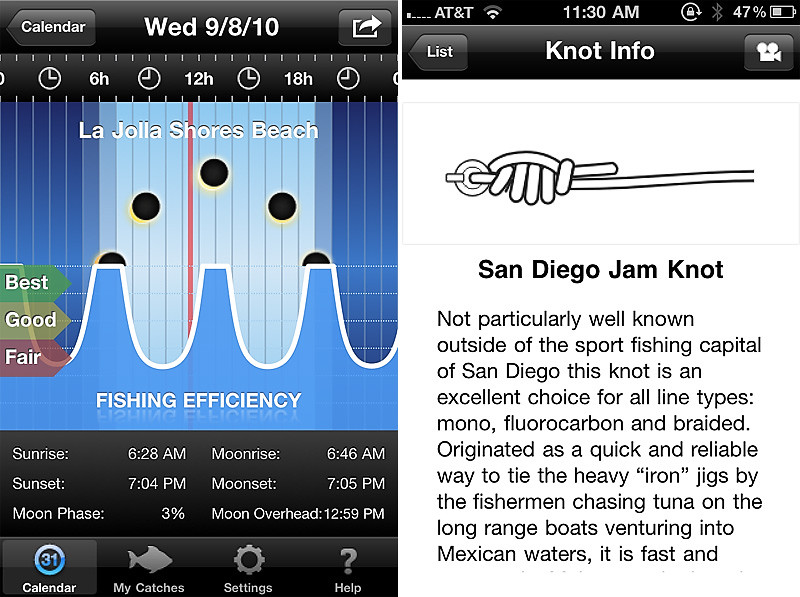 Since kayak fishing is also a form of fitness, I usually have RunKeeper enabled to track my paddling activity. After the activity, you can sync your progress to their website where you can share with others. Here's one I did when I kayak Dana Harbor for the first time last month: http://runkeeper.com/user/davidmai/activity/16104487 Another app I used for mountain biking that I will start using for kayaking is Everytrail. I heard it's a bit buggy for the iOS4, so I'll hold off on that for now. The reason I may switch to that instead of Runkeeper is while Runkeeper is more to track your fitness pace and calorie burn, Everytrail does a better job of tracking your path, route and particularly, the ability to take geotag pictures that overlays on your activity map at the point the photo was taken. Pretty cool. Since we are using our mobile devices on the kayak, I keep things dry using Drycase. Using your mouth, you can vacuum seal the pouch, keeping the device not only dry, but also allow you to use the touchscreen. With the vacuum, you can always tell if the pouch is not sealed properly versus other manufacturer's waterproof case. I never had an issue with their vacuum sealing, but it's nice to be able to tell if the case sprung a leak. 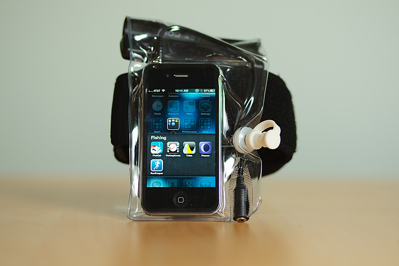 Drycase allows you to use a waterproof headset or bluetooth headset to stay in contact with your fishing buddies who will inevitably call you to check the fishing report. Usually right as you're fighting a fish.  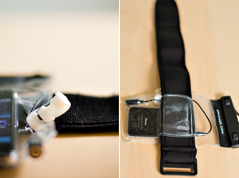 The Drycase comes with an neoprene/velcro arm band that I actually use to strap the device to my thigh. That sets the device in the perfect location to use. For those of you with bigger thighs, you may want to add a velcro extension or buy their waist belt. Lastly, social apps like Loopt and others allow you to share your exact location with friends who may join you after work when you have already launched. Using the built in GPS, it will allow them to find out exactly where you are without the annoyance of trying to verbally tell them while bobbing at sea. I found a fishing social site that I haven't explored yet but will give a try. AnglerSocial.com and the accompanying iPhone app. One of these days, I want to purchase Navionics and give that a try. Anyways, let us know if you have any personal use for your mobile devices while on the water or fishing.[/QUOTE] |

|

|
|
10-08-2010, 11:20 PM
|
#22 |
|
Loves his member
Join Date: May 2010
Posts: 122
|
gps should not be effected by fog... the electromagnetic wave pass right through.
The navionics app is sickening.....anyone know how to plot point or your favorite spot on it. I had a list a while ago of all the offshore spots and couldn't store those waypoints.. Little help? |
|
|
|
|
10-09-2010, 06:19 AM
|
#23 | |
|
Senior Member

Join Date: Mar 2010
Location: Santee
Posts: 904
|
Quote:
Looks a lot like post#1 to me. |
|
|
|
|
|
10-10-2010, 08:34 AM
|
#24 | |
|
Senior Member
Join Date: May 2006
Location: C-bad
Posts: 431
|
Quote:
Great now it's $13.90. I'm installing it right now for the Droid. Any more apps for the droid I can use for fishing and navagation plotting? |
|
|
|
|
|
02-01-2011, 03:49 PM
|
#25 | |
|
Member
Join Date: Aug 2010
Posts: 30
|
Quote:
|
|
|
|
|
|
02-02-2011, 11:16 AM
|
#26 |
|
Greg
Join Date: May 2010
Location: Chula Vista, ca
Posts: 509
|
Does the Navionics map overlay include depth, including the Bays and Channels? Their site doesn't really give a lot of screen shots to evaluate.
Sure, I've got a FF telling me my depth when out there, just thinking it might be nice to know the depth if I'm targeting a specific area. ( hooping and amount of rope required, and how tired I can expect to be from pulling in an area that may be 75' deeper than I thought
|
|
|
|
|
02-02-2011, 03:15 PM
|
#27 | |
|
Olivenhain Bob
Join Date: May 2008
Location: Olivenhain, CA
Posts: 1,121
|
Quote:
The most useful feature for me is the ability to mark way points. You can even take a photo of a fish caught in a particular place and that becomes a way point. You can then use the app to guide yourself back to that way point on a future trip. This app is certainly harder to use than a good GPS or fishfinder/GPS combo but for less than $15 it is hard to beat. Bob |
|
|
|
|
|
|
|


 Linear Mode

