|
|||||||
| Home | Forum | Online Store | Information | LJ Webcam | Gallery | Register | FAQ | Community | Calendar | Today's Posts | Search |
 |
|
|
Thread Tools | Display Modes |
 09-08-2010, 11:04 AM
|
#1 |
|
Member

Join Date: Aug 2010
Posts: 30
|
Mobile phone and apps
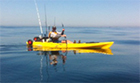
I have an iPhone so I'll share my experiences related to that. Though some of the apps I mention may have Android versions if that is your flavor. For the iPhone, I have a few apps that I find useful before the trip. Tide tracker, moon phases as well as fishing calendar. FishCal is an app that allows you to document your catches as well as check the fishing "efficiency" of any given day. For those of us who became dads and haven't been on the water recently, having a knot reference to refresh ourselves on whether a double uni or a blood knot is better for tying braid to mono.  I use a nice app call FishingKnots for that. I use a nice app call FishingKnots for that.A screenshot from FishCal on the left, and an example of FishingKnots on the right. The animated video in the FishingKnots makes learning how to tie the knot much simpler.  Since kayak fishing is also a form of fitness, I usually have RunKeeper enabled to track my paddling activity. After the activity, you can sync your progress to their website where you can share with others.  Here's one I did when I kayak Dana Harbor for the first time last month: http://runkeeper.com/user/davidmai/activity/16104487 Another app I used for mountain biking that I will start using for kayaking is Everytrail. I heard it's a bit buggy for the iOS4, so I'll hold off on that for now. The reason I may switch to that instead of Runkeeper is while Runkeeper is more to track your fitness pace and calorie burn, Everytrail does a better job of tracking your path, route and particularly, the ability to take geotag pictures that overlays on your activity map at the point the photo was taken. Pretty cool. Since we are using our mobile devices on the kayak, I keep things dry using Drycase. Using your mouth, you can vacuum seal the pouch, keeping the device not only dry, but also allow you to use the touchscreen. With the vacuum, you can always tell if the pouch is not sealed properly versus other manufacturer's waterproof case. I never had an issue with their vacuum sealing, but it's nice to be able to tell if the case sprung a leak.  Drycase allows you to use a waterproof headset or bluetooth headset to stay in contact with your fishing buddies who will inevitably call you to check the fishing report. Usually right as you're fighting a fish.   The Drycase comes with an neoprene/velcro arm band that I actually use to strap the device to my thigh. That sets the device in the perfect location to use. For those of you with bigger thighs, you may want to add a velcro extension or buy their waist belt. Lastly, social apps like Loopt and others allow you to share your exact location with friends who may join you after work when you have already launched. Using the built in GPS, it will allow them to find out exactly where you are without the annoyance of trying to verbally tell them while bobbing at sea. I found a fishing social site that I haven't explored yet but will give a try. AnglerSocial.com and the accompanying iPhone app. One of these days, I want to purchase Navionics and give that a try. Anyways, let us know if you have any personal use for your mobile devices while on the water or fishing. Last edited by BTF_David; 09-08-2010 at 03:56 PM. Reason: Added url links to various websites. |

|

|
|
09-08-2010, 11:14 AM
|
#2 |
|
Member
Join Date: Aug 2010
Posts: 30
|
I'll add a tip for those using Drycase. I usually insert the iPhone top first. That way, the camera isn't obscured by the armband, allowing you to take geotagged photos of your catch and share instantly with your online buddies if you so choose.
You can even put the phone into video mode and capture some underwater footage of your catch. Definitely check the Drycase blog where they have a video with someone doing something similar. Or the video where they attempted to blow up some devices while submerged in a fishtank. Technology is great. Last edited by BTF_David; 09-08-2010 at 11:25 AM. |
|
|
|
|
09-08-2010, 01:19 PM
|
#3 |
|
Senior Member
Join Date: Mar 2010
Location: Santee
Posts: 904
|
Thanks for the tips. Could not find FishCal in the app store. I have a flytomap app installed that has marine maps and GPS data, hopefully it will help me get to the alley. How do you use the drycase on your leg if you want to take a pic? I have used mapmyrun.com for hiking info.
Found the FishCal just needed to click on it. Last edited by old_rookie; 09-08-2010 at 01:53 PM. Reason: Found app |
|
|
|
|
09-08-2010, 01:43 PM
|
#4 |
|
Senior Member
Join Date: Aug 2010
Posts: 344
|
Great info, thx.
|
|
|
|
|
09-08-2010, 01:59 PM
|
#5 |
|
Olivenhain Bob

Join Date: May 2008
Location: Olivenhain, CA
Posts: 1,121
|
Thanks for the post. I look forward to giving these apps a try. Where is the drycase available to purchase?
Next trip out, I was planning on checking out how well the iPhone can track your location while on the water. The thought was that if it was really foggy, Google Maps or some similar application might help point the way home. Has anyone tried this? Bob |
|
|
|
|
09-08-2010, 02:01 PM
|
#6 |
|
Greg
Join Date: May 2010
Location: Chula Vista, ca
Posts: 509
|
GREAT stuff here for the techie in us
|
|
|
|
|
09-08-2010, 02:14 PM
|
#7 |
|
Senior Member
Join Date: Mar 2009
Posts: 2,384
|
Great stuff there. I hope I can find similar stuff for my Blackberry. The Navionics chip is pretty nice for some stuff.
|
|
|
|
|
09-08-2010, 03:06 PM
|
#8 | |
|
Senior Member
Join Date: Mar 2010
Location: Santee
Posts: 904
|
Quote:
I plan to head out Friday morning with gps in a dry bag for cameras. Useable but will take some flighty fuzzy pics. |
|
|
|
|
|
09-08-2010, 03:34 PM
|
#9 |
|
Senior Member
Join Date: Sep 2005
Posts: 1,921
|
I have the Navionics App on my droid. It was ten bucks, and it rocks. Seriously, it is the same maps and info that I spent $200 on a blue chart card for my Garmin. It has depth contour lines, tides, gps, hidden structure, and lots of other goodies.
|
|
|
|
|
09-08-2010, 03:51 PM
|
#10 | |
|
Member
Join Date: Aug 2010
Posts: 30
|
Quote:
I usually take photos from a regular camera I have with me and with the geotagged coordinates from the iPhone photo, I can import and tag the photos taken with the regular camera. |
|
|
|
|
|
09-08-2010, 04:03 PM
|
#11 | |
|
Member
Join Date: Aug 2010
Posts: 30
|
Quote:
Companies like Navigon have stopped selling hardware and make their money via software. I see that as a welcome future for sure. I believe Navionics for iPhone is also $10 like the Droid version. Makes you wonder how they can charge $200 for the versions installed to chartplotters. Perhaps if they make it more reasonably priced, they can make up the profit by selling via quantity? |
|
|
|
|
|
09-08-2010, 10:37 PM
|
#12 |
|
Rum Pirate
Join Date: Mar 2010
Location: Wilds of Mira Mesa
Posts: 388
|
I like my tricorder app. Let's me know where Josh is fishing. Has proved to be the best app yet.
|
|
|
|
|
09-09-2010, 07:55 AM
|
#13 |
|
Senior Member

Join Date: May 2010
Location: Santee, CA
Posts: 103
|
You Techno geeks!
Neat stuff for sure.....I am milking my older phone for now, so the best I can do is email a client from the water! (WOW)..
Now to my point. Last friday am it was foggy. visibility approx 4-500 yards. I took off , turned on my GPS with the intention of marking a few points, and my GPS would not sync up....Poor satellite reception! DARN! So I took out my handy compass, and used it and the depth on my fish finder to navigate....I did a fair job of getting out...It is wierd travelling with out land marks, etc! But a working GPS with maps, or at least points would be faster and easier...but a compass is more reliable.. Note: at home I did a reset of my GPS, and it worked fine... Go figure  cowboybill |
|
|
|
|
09-09-2010, 12:57 PM
|
#14 |
|
Senior Member

Join Date: May 2007
Location: S.D.
Posts: 133
|
gps
i think your gps signal could not go thrugh the dense fog i have similar problem but once the sky clears out mine works fine just my .2$
|
|
|
|
|
09-09-2010, 02:55 PM
|
#15 |
|
Senior Member
Join Date: Mar 2007
Location: Seven minutes from the launch!
Posts: 987
|
What's the point in your GPS if it doesn't work in fog or heavy cloud cover?
Sounds like a great excuse for a better unit, though  . .
__________________
  
|
|
|
|
|
09-09-2010, 03:03 PM
|
#16 |
|
Daddeo
Join Date: Jul 2010
Location: OC
Posts: 660
|
As an option, you could always take an "Coastal Piloting and Navigation" course with the Coast Guard Auxilliary or Power Squadron. They'll teach you things like "dead reconing" and landmark navigation using a compass. That way you'll "be prepared" when your GPS battery runs out or your signal fails.

|
|
|
|
|
09-09-2010, 04:25 PM
|
#17 |
|
Senior Member
Join Date: Sep 2009
Location: Cmont []
Posts: 314
|
Second on the Navionics app for the i phone. And by the way the i phone will work while encased in a ziploc baggie. The only problem with this ap on the iphone is that it runs your battery down faaaaaast!
__________________
"It depends on what the meaning of the words 'is' is." –Bill Clinton |
|
|
|
|
09-10-2010, 10:53 AM
|
#18 |
|
Member
Join Date: Jun 2010
Location: Escondido<->Carlsbad
Posts: 81
|
I'll just point out for those that don't use the links, the knot app is Animated Fishing Knots by John Sherry for $0.99. There is another app that has poorer reviews for the same cost called Fishing Knots by Coffee Entertainment.
|
|
|
|
|
09-10-2010, 11:12 AM
|
#19 |
|
Olivenhain Bob
Join Date: May 2008
Location: Olivenhain, CA
Posts: 1,121
|
I went searching for reviews of the Navionics Mobile app an found a good one on the Kayak Fishing Mag site. http://www.kayakfishingmagazine.net/...ne-review.html
It sold me. I plan to order this app today. Since I always carry my iPhone on the yak and don't currently have a GPS chart tracker, buying this app for around $10 seems like a no-brainier. Now I just have to hope that I don't drop the phone overboard while playing with my new toy. Bob |
|
|
|
|
09-10-2010, 10:17 PM
|
#20 |
|
Senior Member
Join Date: Mar 2005
Posts: 2,563
|
awesome info, THANKS!!!!
__________________
 [------------------------ [------------------------ <)))< ....b-a-a-a-a |
|
|
|
|
|
|


 Linear Mode

